Thứ hai, 09/06/2025 | 22:58 GMT+7
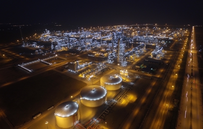
Analysing the spatial distribution of land surface temperature at Nghi Son refinery and petrochemical complex using Landsat and Sentinel 2 satellite image data Trinh Le Hung Military Technical Academy Email: trinhlehung@lqdtu.edu.vn Summary: The Landsat 5, Landsat 8 and Sentinel 2A satellite image data are used for extracting land surface temperature, thereby mapping the spatial distribution of land surface temperature at Nghi Son Refinery and Petrochemical Complex. The obtained results then can be used in monitoring land surface temperature changes, for land use planning as well as in minimising the impact of production processes to the environment. Key words: Land surface temperature, thermal infrared remote sensing, Nghi Son Refinery and Petrochemical Complex |

Các hoạt động khuyến công được các đơn vị tại Bắc Ninh tổ chức nhiều năm qua, thông qua việc bình chọn sản phẩm công nghiệp nông thôn tiêu biểu, nhằm tôn vinh các sản phẩm chất lượng, giá trị sử dụng cao, có tiềm năng phát triển.
06/06/2025


Đối với ngành da giày, các hiệp định thương mại tự do không chỉ mang lại cơ hội gia tăng xuất khẩu mà còn thúc đẩy sự đổi mới, chuyển đổi chuỗi cung ứng và cải thiện chất lượng sản phẩm để đáp ứng các tiêu chuẩn quốc tế.
04/06/2025